Crews continue attack on Bernard Fire
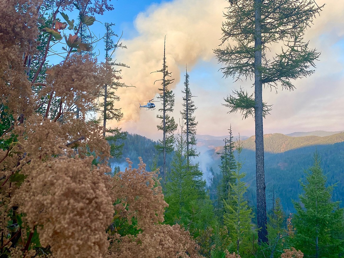
A view of the Bernard Fire looking to the east.
(Photo courtesy Emily Hewitt, Kaniksu Wildland Fire Module)
BAYVIEW — Fire activity continues to move west near Bernard Peak as firefighters work to bring the 1,243-acre Bernard Fire under control
Discovered almost two weeks ago, U.S. Forest Service officials said the fire, determined to be human-caused, is about 20 percent contained. Fire crews are focused on limiting spread of the fire with an additional control line under construction. In addition, Stimson Lumber has constructed dozer line along their boundary to the west of the fire.
The Panhandle Hotshot crew is working on the north side of West Gold Creek drainage to keep the fire from crossing the creek. In addition, engines and heavy equipment continue to improve control lines on the east side of the fire perimeter.
A 20-person crew, four engines and two tenders continue to clear the fuel break west of Lakeview. Limited air operations were place Thursday and were expecting to be able to expand flights and aircraft Friday as air conditions improve.
The Bernard Fire is threatening private property, structures, and infrastructure at Gold Creek Lodge and the Lakeview community.
An active rockslide on the cliff face below Bernard Peak is putting boaters near the shoreline at risk of severe injury and death, USFS officials said in a press release updating firefighting efforts.
"Visibility on the lake is poor in the vicinity," the release said. "Campers and boaters are strongly advised to stay clear of the shoreline and lake near the fire area."
Temporary flight restrictions are in effect around the entire fire area and boaters are asked to stay clear of firefighting aircraft that are using Echo Bay to fill buckets and scoop water.
"Remember that temporary flight restrictions also apply to unmanned aircraft systems [drones], so if you fly, we can’t," USFS officials said in the release.
Over near Coolin, the West Branch Fire is about 35 acres and was discovered Wednesday morning. Located about 9 miles due west of Coolin near Forest Service Road 1094, the fire is about a half-mile west of the Idaho/Washington state line.
The fire has been determined to be human-caused. Initial size-up at discovery was 20 acres, and a Type 3 Helicopter was used on 9/16 for bucket-work.
Over near the Idaho/Montana border — about nine miles southwest of Troy, Montana — the Callahan Fire is exhibiting moderate fire behavior, creeping and backing, and causing single tree torching.
"The fire is burning in steep, rocky ground in an early 1990s burn and is expanding into areas of continuous live and dead fuel, some of which has not had disturbance for approximately 70 years," according to information on the fire on InciWeb, an online database on wildfires.
The fire, detected on Sept. 8, is located on the Three Rivers Ranger District of the Kootenai National Forest in Bonner County.
More than 300 firefighters are battling the 1,676-acre wildfire.