Rain helps dampen area fires


BONNERS FERRY — Rains which fell Thursday and Friday significantly decreased Kootenai River Complex fire behavior to smoldering, Bonners Ferry Ranger District officials said.
"Heat remains in heavy fuels and those sheltered by tree canopies that didn't receive as much moisture," officials said in a Saturday press release.
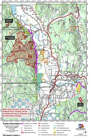
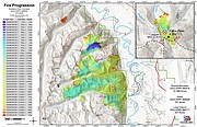
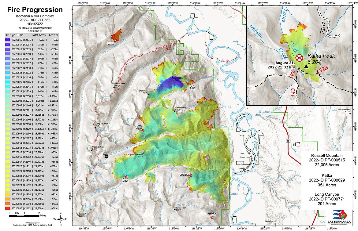
The fire, which was sparked by lightning in mid-August, has burned an estimated 22,559 acres. Targets needed to reach containment are at 85 percent. There are 155 firefighters assigned to the fire.
Firefighters are continuing to monitor the Long Canyon Fire from the air and lookout points as visibility and conditions allow, BFRD officials said. In addition, an engine crew and wildland fire module are assessing structure needs up Smith Creek.
The Katka Fire remains unstaffed and is monitored by air resources as conditions allow.
Crews are continuing efforts to widen and strengthen control lines to the west of Westside Road, and to connect dozer lines with nearby handlines where needed.
"Firefighters are positioned to fight the fire directly if it backs down to these control lines," ranger district officials said. "Where this has already occurred, crews are cooling hot spots and creating 50 feet of depth into the fire interior to increase containment."
Heavy equipment is being moved as needed to strengthen lines and for suppression repair work. Additionally, firefighters are turning on and testing sprinkler systems around structures to wet the ground and ensure they are working.
Boulder Mountain Fire
The Boulder Mountain Fire has burned 2,310 acres and has been contained to 99% contained. The Washington Department of Natural Resources and Colville National Forest is monitoring the wildfire.
While the Colville National Forest has lifted a closure enacted for the duration of the fire, officials warned that many natural hazards can exist for months – if not years – after a fire is out, including unstable dead or dying trees, burned out root systems and unstable soils.
Diamond Watch Fire
Crews are keeping an eye on the leading edge of the Diamond Watch Fire as as it approaches FS road 308. Efforts are being taken to keep the fire from crossing roads on the south, east, west of the fire as well as at Diamond Creek on the north edge of the fire, officials said.
The Diamond Watch Fire is 60% contained, fire officials said in a press release.
Since started by a lightning strike in mid-July, the Diamond Watch fire, has burned 1,220 acres. Located 5.5 miles due west of Nordman, the fire has 16 fire personnel assigned to the fire.
Columbus and Bear Gulch Fires
The Columbus Fire, started by a lightning strike in August, is straddling the Idaho/Montana corner near the Columbus Creek drainage.
Located 6 miles northeast of Murray, the fire has burned 2,298 acres and is 0% contained.
Located 6 miles east of Murray, the Bear Gulch Fire has burned 144 acres since being sparked by lightning in mid-August. The fire is within a mile of the Idaho/Montana border with terrain similar to the nearby Columbus Fire.
Fire officials expect containment of the fire by the end of October.
Thor Fire
The Thor Fire — along with the Slate, Salmo and Gypsy Ridge fires — is burning in an area where the fire activity does not pose a threat to any “values at risk,” including wildlife habitats, watershed areas, natural resources, recreation infrastructure, or private land.
The largest of the fires, the Thor Fire, has burned 1,300 acres; the Slate Fire, 620; Salmo, 320; and Gypsy Ridge, 17.
Closure, evacuations and information
• On the Kootenai River Complex, the following Forest Service trails and roads are closed: Ball Creek Road (FR 432), Trout Creek Road (FR 634), Russell Mountain (No. 12), Russell Ridge (No. 92), Ball and Pyramid Lakes (No. 43), Pyramid Pass (No. 13), Pyramid Peak (No. 7), Fisher Peak (No. 27), Trout Lake (No. 41), McGinty Ridge (No. 143), Clifty Mountain and Clifty/Burrow (No. 182), Myrtle Peak Trail (No. 286), and Burton Peak Trail (No. 9). Westside Road is limited to residents only.
• On the Diamond Watch Fire, closure orders are in effect for Forest Service roads 311, 308, and 1362H in the vicinity of the fire. However, FSR 1362 remains open. Petit Lake and is associated campsites are within the closure area.
Some camping areas along the southwest portion of Sullivan Creek Road have been notified that they are on a “set” be ready evacuation status and should be ready to leave if asked by local authorities.
• On the Coeur d'Alene Ranger District, closures include Trail 148 along Casper Creek, Trail 7 from the intersection with Trail 774 to Thompson Pass, Trail 1107 near the state line, Trail 763 near the state line, Forest Service Road 938, FSR 430 and FSR 604CZ.
• All methods of travel are prohibited (foot, mechanized, motorized and stock) on the closed roads and area.
• A temporary flight restriction is in place on the Katka Fire as well as on Scotch Creek, Russell Mountain, Eneas Peak and Trout fires. As a reminder, civilian drones are not allowed around active fires. Flying drones near an emergency scene is against the law and forces fire crews to ground their flights.
Information: InciWeb.nwcg.gov